Drones and AI in African Wildlife Conservation: Case Studies, Use Cases, Benefits, and Limits
Across Africa, conservation teams are being asked to protect wildlife across enormous landscapes with limited staff, constrained budgets, and growing pressure from poaching, habitat loss, and human-wildlife conflict.
That is why drones and artificial intelligence are attracting so much attention. Used well, they can help rangers detect threats faster, monitor animals more accurately, and respond with better information. However, their value hinges on their deployment, the problem they address, and their compatibility with local conservation realities.
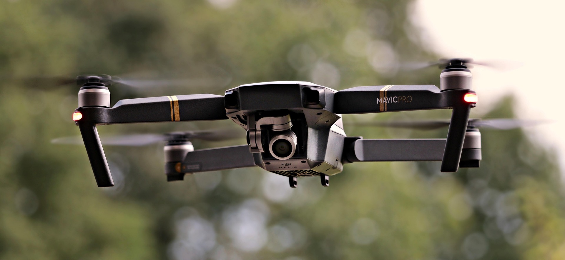
Drones and artificial intelligence are becoming more important in African wildlife conservation because they help teams monitor larger areas, respond faster to threats, and use limited field resources more effectively. In South Africa, a recent drone-and-AI wildlife census known as Project Gaia covered 100,000 hectares across the Timbavati and Sabi Sand Nature Reserves.
Why Drones and AI Matter in African Wildlife Conservation
African conservation operates at a scale that makes conventional monitoring difficult. Protected areas can stretch across tens of thousands of hectares, ranger teams are often under-resourced, and threats range from poaching to crop-raiding elephants to the slow degradation of habitat.
In that context, drones and AI are appealing because they expand visibility, speed up data collection, and help teams prioritize action.
This matters because the goal is not just “more technology.” The goal is better field decisions. A drone can cover terrain that would take patrol teams hours to cross, while AI can process imagery, thermal data, or patrol histories faster than a human team working manually.
When those tools are tied to ranger response and outcome tracking, they become part of a practical conservation system rather than a tech demo.
What Drones and AI Actually Do
At a practical level, the workflow is simple. A conservation team identifies a problem, such as suspected poaching activity, elephant movement near farms, or the need for a wildlife census. A drone is then deployed to collect image, video, or thermal data. AI or computer-vision tools help interpret that data, flag patterns, or speed up classification. Rangers, reserve managers, or response teams then act on the findings, and the results are reviewed to improve future operations.
That end-to-end chain is important because drones alone do not protect wildlife, and AI alone does not either. The conservation value comes from linking surveillance, analysis, response, and follow-up.
Top Conservation Use Cases in Africa
Anti-poaching surveillance
One of the clearest use cases is anti-poaching surveillance. Drones equipped with thermal cameras can extend monitoring into low-light conditions and difficult terrain, helping teams detect suspicious movement faster than ground patrols alone. AI can further support this by improving screening, prioritization, and route planning. Uganda’s PAWS project is a strong example of AI helping optimize patrol allocation against poaching risk, while Southern African reserves are increasingly using drone-supported monitoring in high-risk conservation settings.
Wildlife census and species counting
Drones are also becoming more useful for reserve-scale wildlife census work. In South Africa, Project Gaia was completed across 100,000 hectares of the Timbavati and Sabi Sand Nature Reserves using drones, machine learning, and AI to survey large mammal species. Reserve communications reported roughly 2.85 million images, 30TB of data, and more than 50 species mapped, showing the scale at which this model can operate.
Thermal detection at night
Thermal imaging is especially relevant in conservation because many threats and animal movements intensify after dark. In Tanzania, Kazi ya Tembo describes using thermal drones for night-time elephant monitoring alongside rapid response units and ranger training, framing the technology as part of coexistence management rather than stand-alone surveillance.
Human-elephant conflict mitigation
Human-elephant conflict is one of the strongest Africa-specific use cases for drones. Kazi ya Tembo focuses on protecting crops, reducing conflict, and improving coexistence through drones, ranger teams, and community programs in Tanzania. In Kenya, Mara Elephant Project reported that its drones flew more than 360 hours in 2025 and helped mitigate 277 human-elephant conflict incidents, accounting for over 60% of the incidents their ranger teams mitigated that year.
Patrol optimization and smarter deployment
Not every conservation AI story is about flying hardware. Some of the strongest examples involve decision support. The PAWS system, tested in Uganda’s Queen Elizabeth National Park and described in AAAI publications, was designed to optimize how scarce ranger patrol resources are deployed by using historical patterns and game-theoretic modeling. That matters because conservation bottlenecks are often operational, not just technological.
Habitat and movement monitoring
There is also growing interest in combining AI with satellite imagery and other sensing tools for large-area habitat and wildlife monitoring. But this use case needs careful framing. A Connected Conservation Foundation study on AI-assisted satellite wildlife surveys in African savannah settings found some promise, but also concluded that the system did not yet provide the counting and species-classification accuracy managers needed compared with ground-based sightings. That is a useful reminder that not every monitoring problem is best solved by the same technology stack.
Closing summary
The strongest conservation results do not come from drones or AI alone. They come from combining technology with experienced field teams, local community relationships, ecological knowledge, and a clearly defined operating strategy. In Africa, the most promising examples are not the flashiest ones. They are the programs where better data leads to better decisions in the field.
Like this page?
Wildlife home
 |
Wildlife conservation
 |